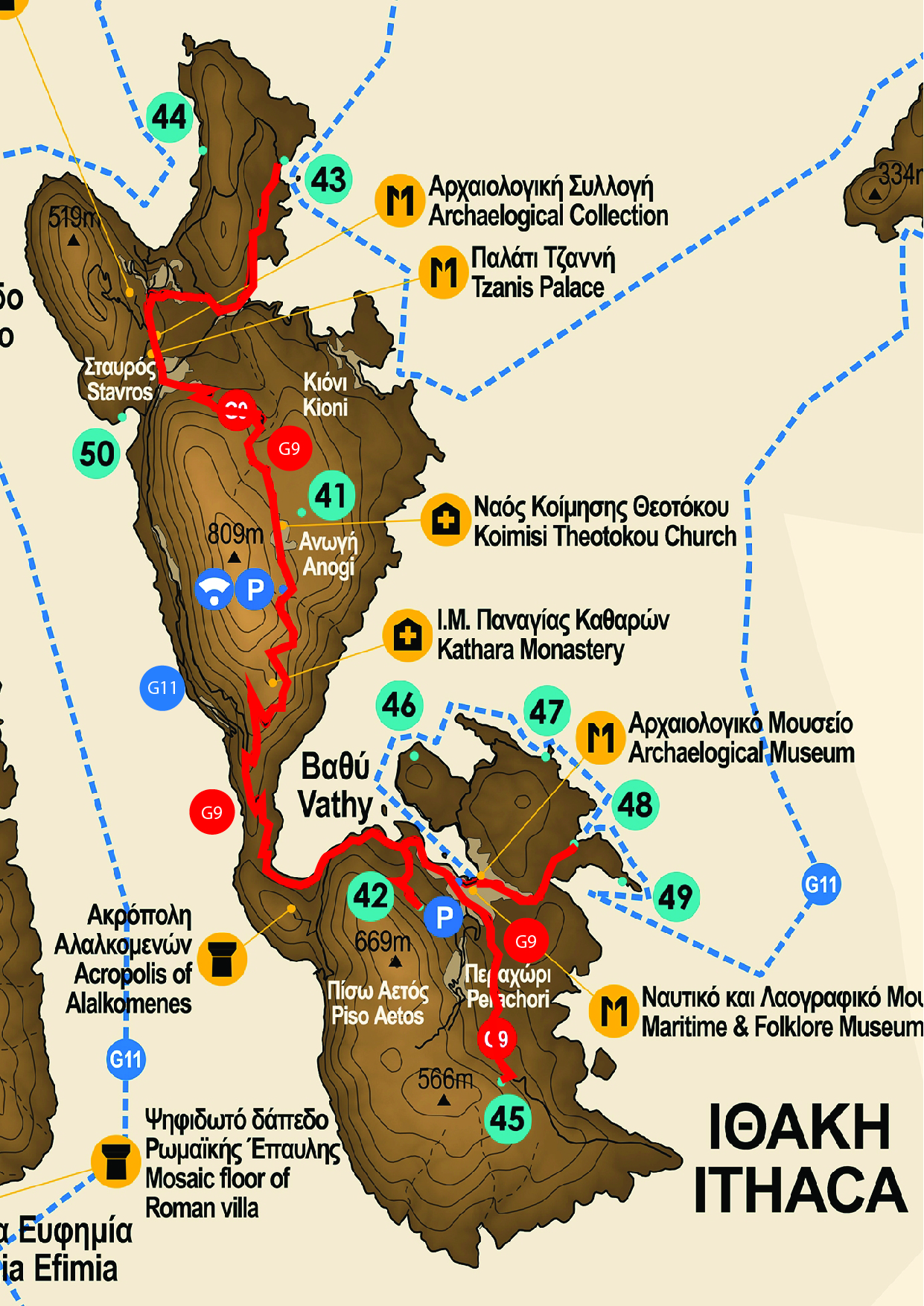
The georoute of Ithaca begins at the northern part of the island and specifically at Geosite Marmakas which consists of a beach and a wetland (the only one on the island), located close to the picturesque port of Frikes village. At this Geosite we observe the occurrence of three lithological sequences, i.e. three different formations of the Ionian zone: the "Pantocrator" limestones, Ammonitico Rosso and the limestones with cherts and marly shales with “Posidonia”.
Following the georoute and heading towards the south along the main road, we make a small detour to the west, towards Exogi village, to stop at Homer's School, an archaeological site with an ancient fortification tower of the Classical - Hellenistic period with signs of Mycenaean architecture. Then we continue to the village of Stavros where Stavros Archaeological Collection is found, which hosts finds from all the excavations conducted in northern Ithaca since the beginning of the 20th century. The objects exhibited date from the Early Greek to the Roman period. Most of them come from the excavations that took place at the Geosite of Loizos' Cave at Polis bay, that we can visit by making a detour. In this coastal cave remarkable finds dating from the Early Helladic to the Roman period have been discovered, among which a fragment with the inscription "WISH ODYCCEI". At Stavros village we can also visit the Tower of Tzanis, one of the few examples of houses built during the Venetian occupation with interesting architectural elements that has been declared a historical monument.
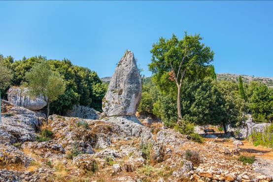
We continue our route to the village of Anogi where we come across another Geosite with huge scattered boulders of limestone of geological origin, the "Monoliths" (or Menhir) of Anogi. "Araklis" is the biggest among the Monoliths, these particularly eroded karstic geomorphs. At the settlement of Anogi it is located the Information Center of Kefalonia - Ithaca Geopark opposite a historical religious monument, the Holy Temple of the "Assumption of the Virgin" with beautiful frescoes dated back to the 17th century.
Proceeding on the same road, there's the View point to Vathi, Gidaki and Skinos bays. These areas constitute a Geosite where we can admire the particular geomorphology of these bays, formed due to eustatic movements of the sea from the alteration of glacial and interglacial periods during the last 2 million years. A little further down it is the crossroad for the Holy Monastery of Kathara, which according to tradition, was named after the discovery of the icon of Virgin Mary, at the point where the monastery was then built, since "kathara" (in the local dialect) means the dry shrubs from which it is believed that the icon was retrieved. The view from this point is unique; we can observe the whole southern part of the island of Ithaca, as well as Kefalonia Island from the other side. As we continue the route to the south we find the walls of the ancient city of Alalkomenes that are preserved at Piso Aetos (Agios Georgios - Fortification walls), as well as the area with the ruins of the ancient city that are preserved outside the walls. Before taking the road to Vathi we could take a detour to Geosite cave of the Nymphs in which archaeological finds indicate the worship of the Nymphs.

Arriving at Vathi, the capital of Ithaca, we can visit the Nautical - Folklore Museum which includes more than 1.500 exhibits, including old photographs, paintings of Ithaca’s shipowners, naval instruments and uniforms. Close by it is located the Archaeological Museum which exhibits small objects dedicated to the temple of Apollo in the area of Piso Aetos, a small bronze bust of Odysseus and a significant number of vessels made in local laboratories according to the "Ithacan Protogeometric style".
Completing the georoute of Ithaca we head either towards Geosite cave Rizes which is located close to Perachori village or to Geosites Filiatro and Sarakiniko where from a second View Point we can see almost the entire stratigraphic sequence of the Ionian zone that characterizes lithologically the island of Ithaca.