The island of Kefalonia has been inhabited since the Old Stone Age. In line with the finds, the first known inhabitants of the island derived from the Leleges tribe, who worshipped Poseidon, the god of the sea.
According to mythology, Kefalonia was named after its first king, the mythical hero Cephalus, who conquered the island later, in the Bronze Age, together with the Mycenaeans and their leaders Amphitryon (Hercules' father) and Eleios (Perseus' son).
Diverse versions exist about Cephalus’ origins; he might have been the son either of the Phocaean king Deion, or of Hermes and the priestess of Athena Herse (the word herse etymologically means drew, that was considered to be a gift of the moon-goddess Selene to the mortals), or even a descendant of Aeolus’ son, Endymion.
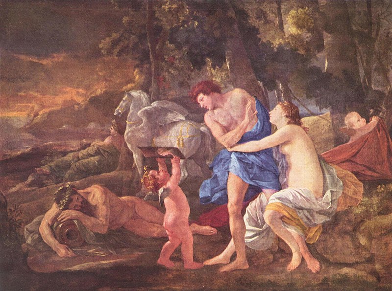
Cephalus myth is also related to his pursuation by Eos, the goddess of the dawn, who fell in love and tried to seduce him. She carried him off to Syria, where she gave birth to their son named Tithonus or Phaethon.
Up to a certain point, Kefalonia was ruled as a single unit, while later on, the island was named "Tetrapolis" by historian Thucydides, due to the foundation of 4 autonomous ancient Greek Polis (cities) – States. These ancient Polis called Palli, Sami, Pronni and Krani were named after mythical hero Cephalus' sons (Paleas, Samos, Pronisos and Kranios).
According to mythology, another Cephalus’ son, Archeisius, was Laertes' father and Homeric hero Odysseus' grandfather. Actually, the Kefalonians are mentioned for the first time in the Iliad epic poem, as participants in the Trojan War with their fleet, under Odysseus' leadership.
It has been claimed that those Homeric "Kefalonians" (named "Kefalanes" in the Dorian dialect), made part of a wider Kingdom which comprised except Kefalonia, the islands of Ithaca, Zakynthos, Lefkada and a part of Acarnania district in the Western Greece. They belonged to the Pelasgian tribe, who had initially settled on the mountainous Acarnania area, and moved near the sea during the Bronze Age, to make use of the trade-routes for commerce. According to the historian Efstathios Livieratos in "The history of Kefalonia" (1916), they might have been named Kefalonians, after the peaks of the Acarnanian mountains they came from, as in the ancient Greek language, the word peaks (in Greek "korifes") was synonym to heads ("kefales").
Kefalonia is an island of historical interest with many monuments and sites that testify human activities and civilization from the prehistoric period to modern times. Important reference sites of early human activity in Kefalonia comprise the Quarry in Minies with evidence of extraction and in-situ processing of pyrites occurred during the Old and Middle Stone Age as well as Drakaina cave in Poros gorge where there have been detected traits of ritual gatherings during the Neolithic period that testify the existence of organized and extroverted prehistoric societies living on the island.
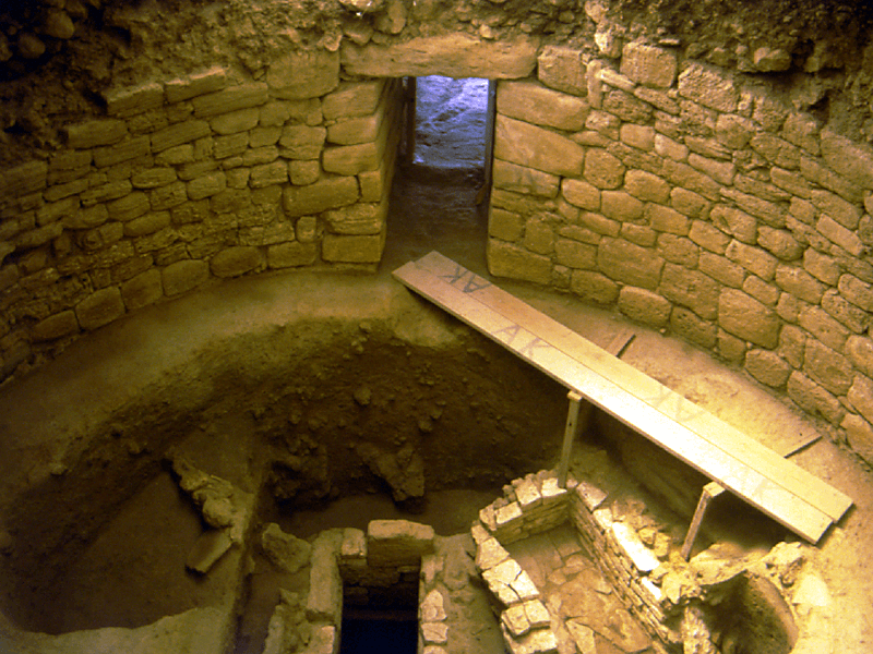
In antiquity, highly developed civilization occurred as it is evidenced by the abundance of monuments built around the island such as the popular Mycenaean tombs at Tzanata (Fig. 1) and the ancient cemeteries of Mazarakata, Lakkithra and Kondogennada, as well as the city walls of ancient Krani and the broader area of ancient city of Sami with the remnants of the Acropolis and its surrounding walls.
Most of the Mycenaean Cemeteries are located around the plain of Krania, in the southern part of the island. These burial structures are all oriented towards south or southwest and benefit from solar radiation more hours per day. Besides, mount Aenos that surrounds the plain, functions as a natural barrier and protects them from the cold northern winds. These burial sites have been easily accessible as they are mainly located at low altitudes of mild relief. Little is known about the respective settlements that might have been located on the hills around the plain.
The Mycenaean Cemetery of Mazarakata is located at the foot of the hill castle of Saint George. It had been widely used during the heyday of the Mycenaean period (14th - 11th century BC) and is the largest cemetery discovered in Kefalonia. It includes 16 chambered tombs plus another discovered after its collapse. The predominant rock in the area is sandstone and thus Pliocene limestone had been used for the construction of the chambers, carved parallel to each other to form a burial cluster. This type of chamber arrangement of Mycenaean tombs is often met in Kefalonia, while it is rarely seen to the rest of the Mycenaean Greece.
During those days and the following years (in the Mycenaean era and till the Classical period), the economic development of the island was based on the natural resources including agricultural and maritime activities that rendered Kefalonia famous for its timber, olive oil and wine production and of course its maritime power.
During the Roman period, the island of Kefalonia continued to be an important center of maritime activity. The remains of Roman villas at Skala and Agia Efimia, and the Roman baths (Balnea) in Sami as well as in Fiskardo where it was also discovered a Mausoleum and a Roman cemetery provide precious information about the daily life during those days.
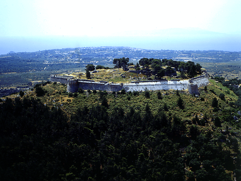
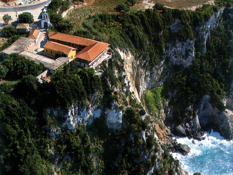
During the Byzantine and the Post-Byzantine period, Kefalonia played a key role in defense and claim of great powers interests in the Ionian and the wider area of the Mediterranean Sea. Therefore, the island was targeted and attacked by pirates and an economic and social turmoil was created during Xenocracy. The monuments of that period were built for defense - fortification (St George’s Castle, Fig. 2) or for religious purposes (Holy Monasteries of Atros, Kipoureon, Fig. 3, Saints Fanenton, etc).
During the 19th century, Kefalonia got under the English occupation and the conquerors invested in the construction of public and private works around the island (De Bosset Bridge in Koutavos lagoon, Stevenson watermill in Karavomylos). However, in 1864 English left and it took place the much desired union of Kefalonia with all the rest of the Ionian Islands with Greece. Urbanization was on the rise improving economic growth and the development of trade and products processing, apart the sector of primary production.
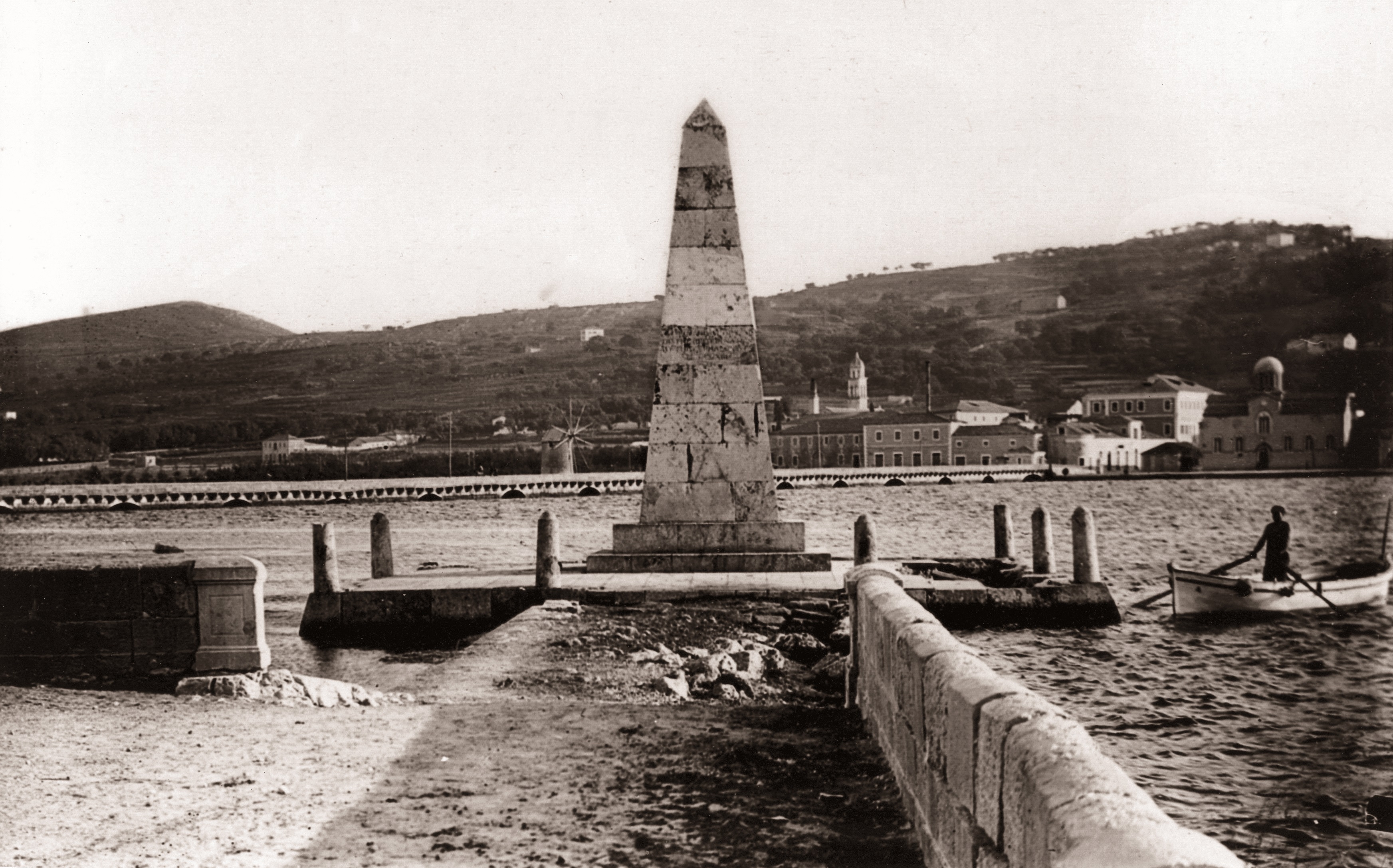
In the 20th century, living conditions became rather challenging for the inhabitants of the island, with the occurrence of the two World Wars (Italian War Memorial of the Acqui Division in Argostoli), the Civil War afterwards and the catastrophic earthquakes in 1953 leading to the destruction and dereliction of even entire villages such as Old Vlachata and Digaleto.
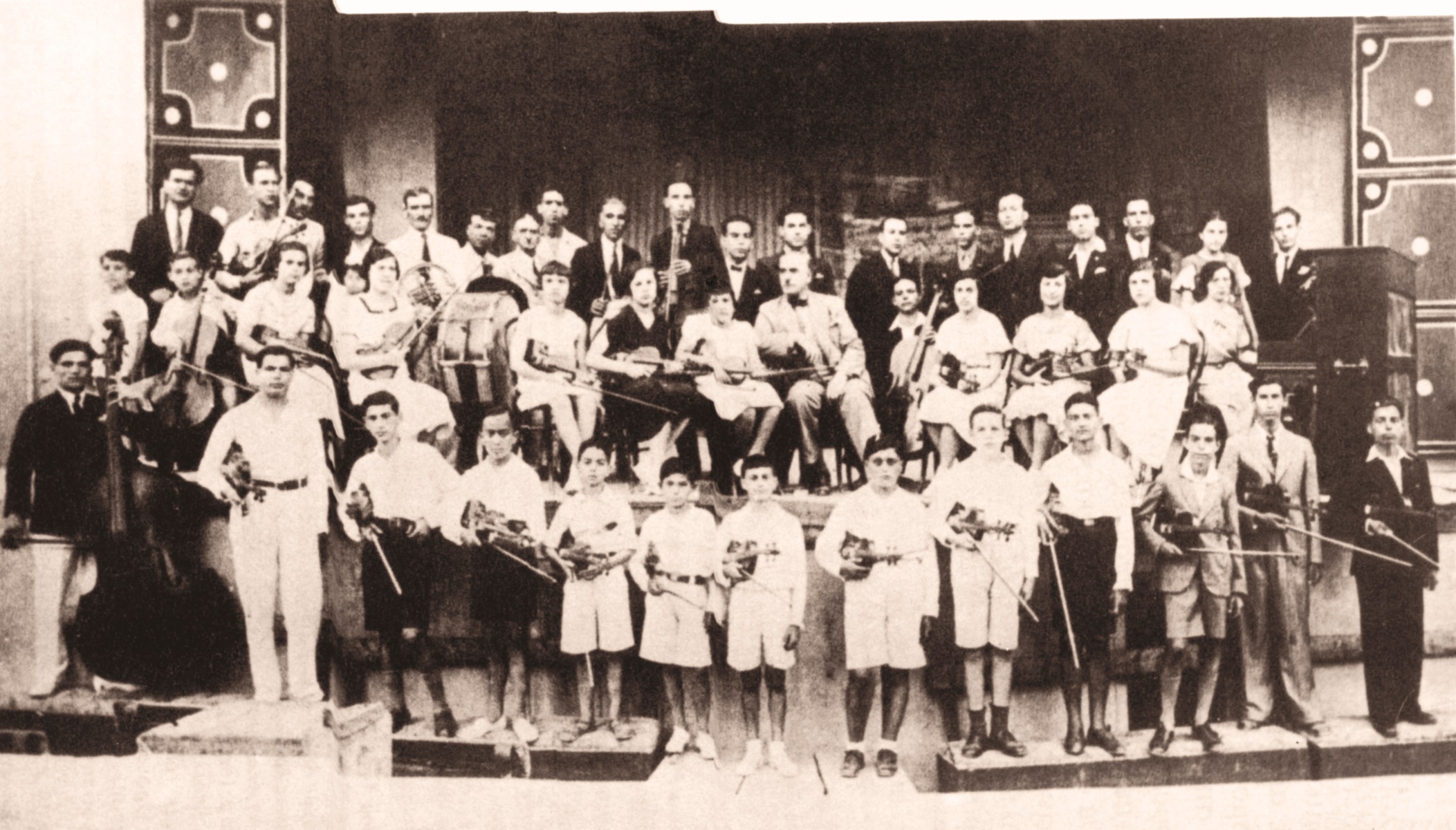
The historical richness of Kefalonia reveals the configuration of an interesting and diverse cultural background with impacts from all the different periods mentioned above. Characteristic examples comprise Kefalonian dialect with obvious influences of conquerors’ Latin languages and idioms and the great musical tradition of the island including philharmonic orchestras, serenades and traditional songs. The folklore of the island is also very rich and includes traditional dances such as Kefalonian Syrtos, Divaratikos, Mermigas, etc., traditional costumes and recipes (Kefalonian meat pie and burdetto). Besides, there are many local customs for every single important celebration and event, and less common traditional practices such as embroidery using the evergreen succulent Agave americana and the collection of salt from sea water ponds. There are also well-known Kefalonian products such as robola wine, a local white variety with Superior Quality Designation of Origin (OPAP) and mandoles (candied almonds).
In addition, Kefalonia represents an important holiday and religious destination, with a well-developed net of agritourism and many cultural events and traditional festivals to listen, dance and enjoy local music and food. During summer the island hosts various artists who organize and participate in Saristra Art Festival and SeaNema Open Air Film Festival by the Sea.
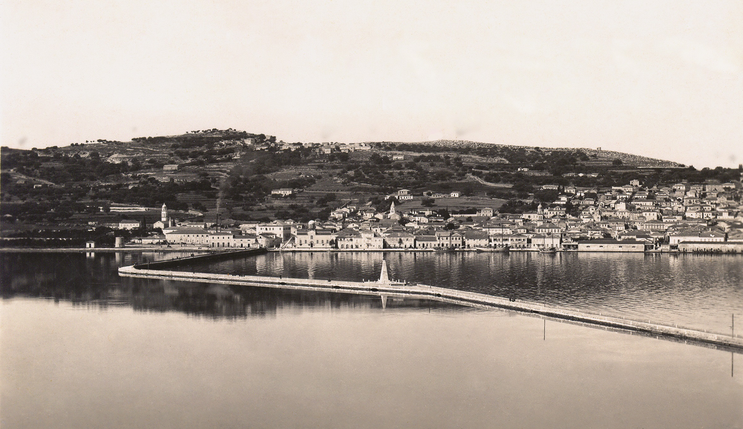
Kefalonia before the 1953 earthquakes
The area of the Geopark is characterized by high seismicity and considered to be one of the most seismic areas in Europe. During the summer of 1953 (August 9th - 12th), the seismic sequence of three large earthquakes of increasing intensity provoke extensive damage to Kefalonia, Ithaca and Zakynthos Ionian Islands; 455 people were dead, 2.412 injured and 21 missing. On the 12th of August it took place the most catastrophic among those seismic events having magnitude 7.2 on the Richter scale; the epicenter was located at Kefalonia southeastern part, and caused the island’s rise about 60 centimeters. Kefalonians assisted on the collapse of their houses and many of the inhabitants emigrated due to rumors that the island would have sunk. Since then, in the island the measurement of time has changed in pre-seismic and post-seismic eras. That leveling of settlements probably built on shallow foundations, became the milestone for the modern history, tradition and cultural heritage of the island. The collection and issue of newspaper articles and photographic material concerning that period, as well as the creation of relevant exhibitions and documentaries, has the aim to salvage the marks of that Kefalonian culture, suddenly lost.
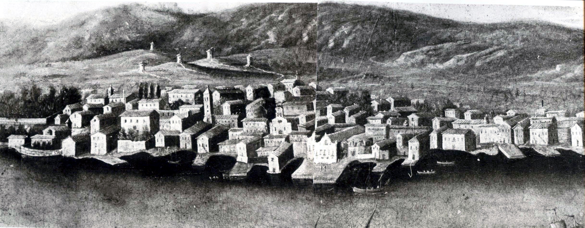
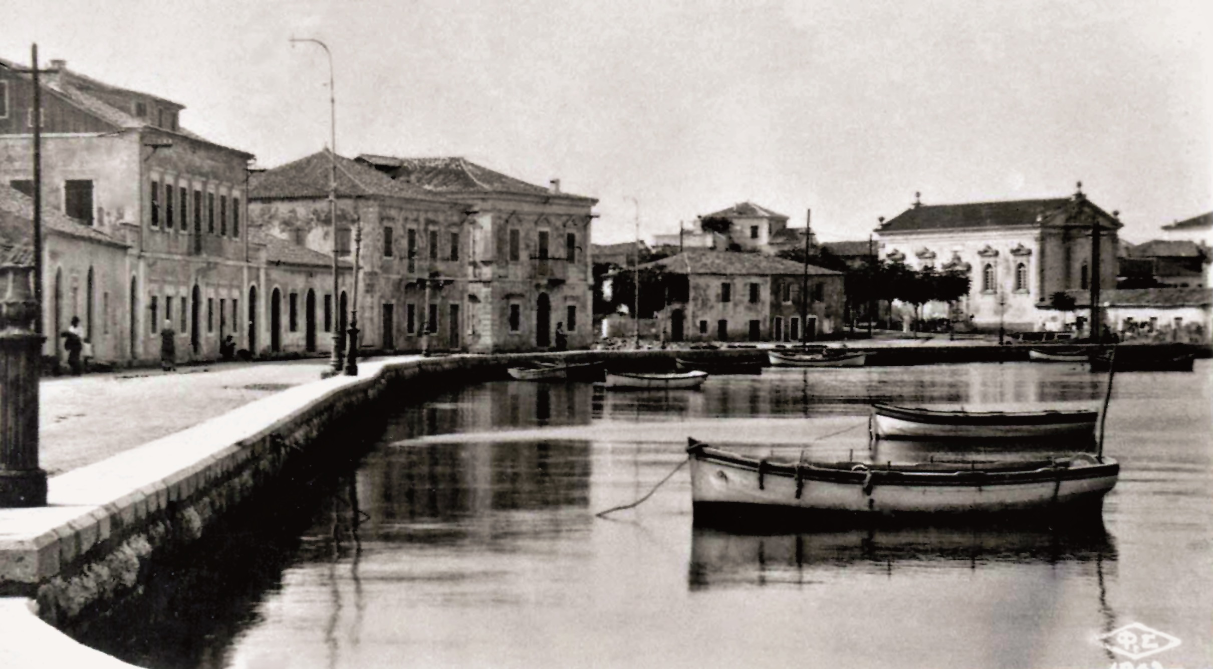
Argostoli was completely destroyed during the catastrophic earthquakes. Nothing remained but ruins of buildings that used to testify its past. It used to be a small leeward port (Fig. 4) up to the middle of the 18th century, when it was designated as the capital of the island according to a decree issued by the Venetians in 1757.
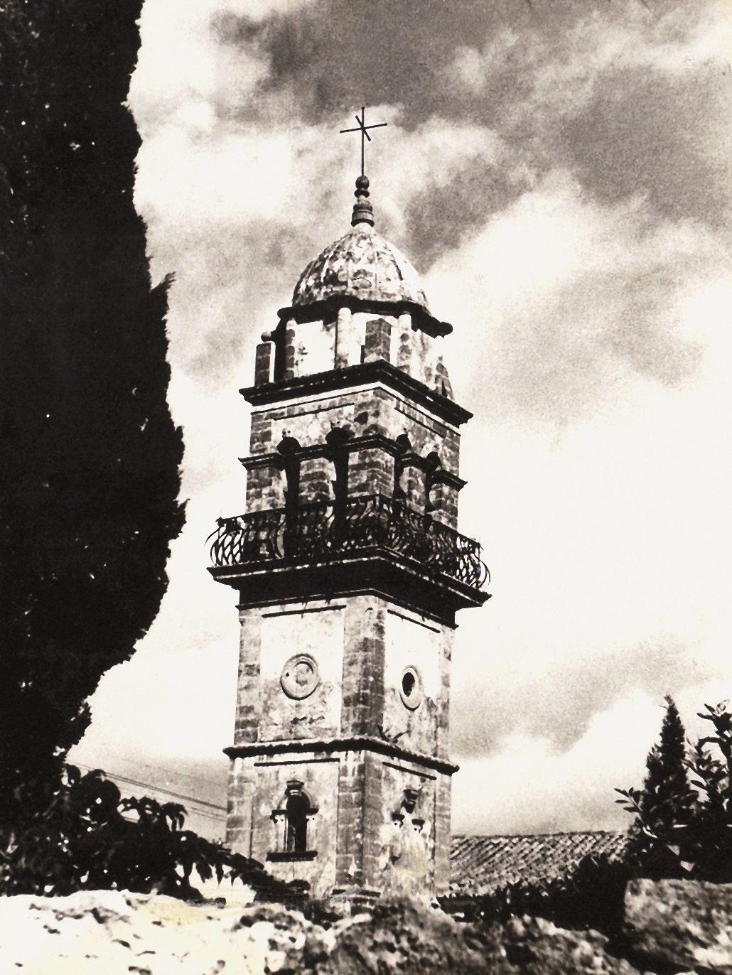
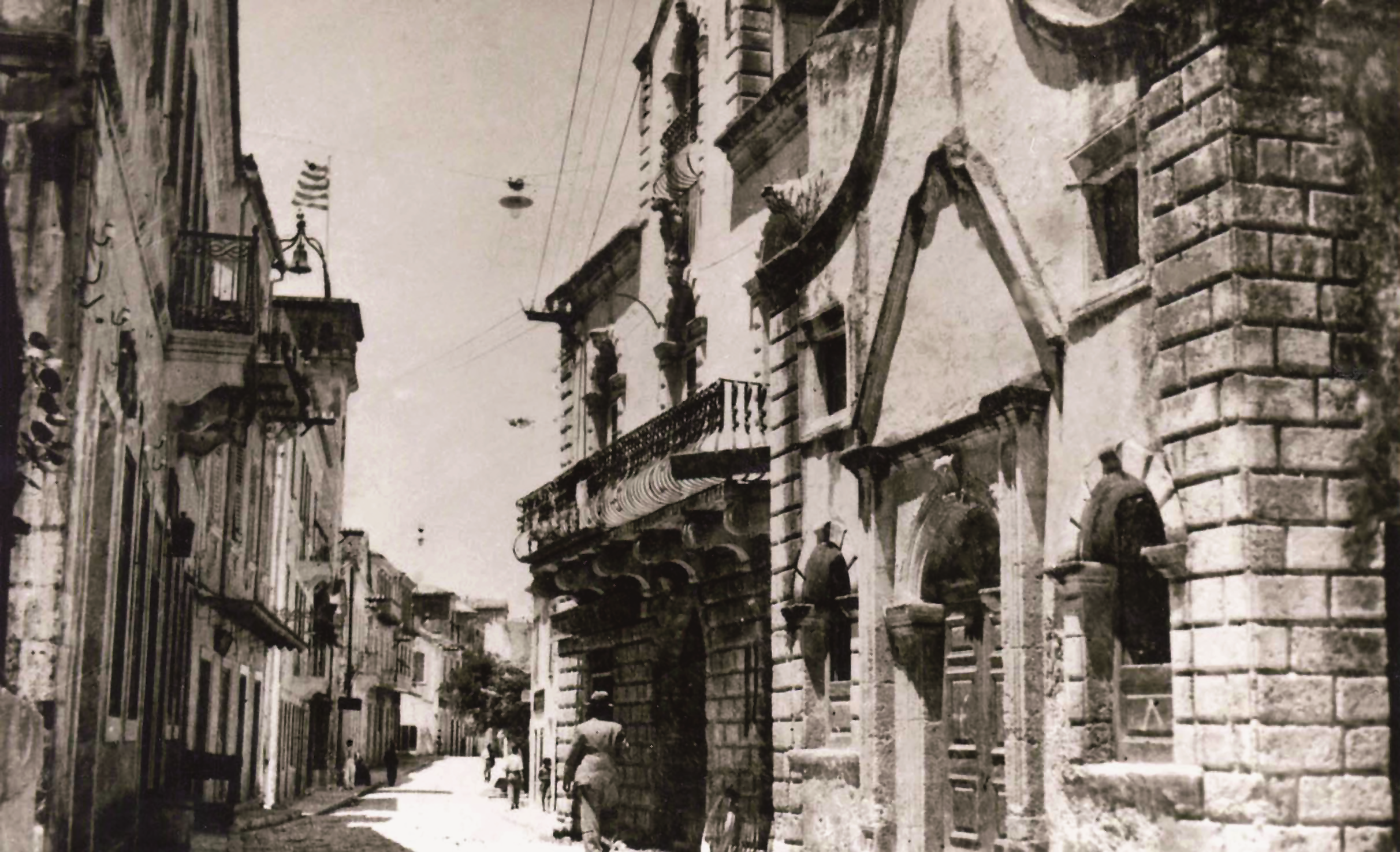
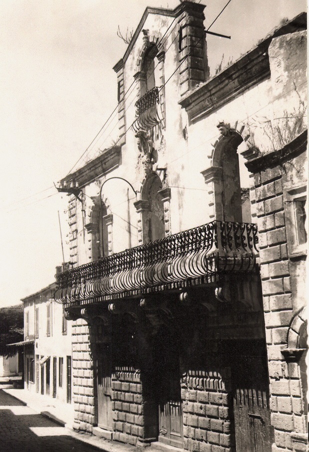
As a consequence, it became an urban center with many samples of Italian architecture and Venetian baroque influence mainly in churches (Fig. 5) and Conte Anninos and Conte Metaxas mansions (Fig. 6, 7), both built earlier than 1757.
During the period of the British rule and until the Union of the Ionian Islands with Greece (1815-1864), Charles Philippe deBosset who was the first Military Governor of the island and afterwards Governor Charles James Napier with his Irish technical consultant and engineer J.Pitt Kennedy undertook the urban planning and development of Argostoli and the construction of important technical works such as the bridge of Drapanos (deBosset’s bridge) (Fig. 8, 9) by using Pleiocene limestone from the area of Maitland,
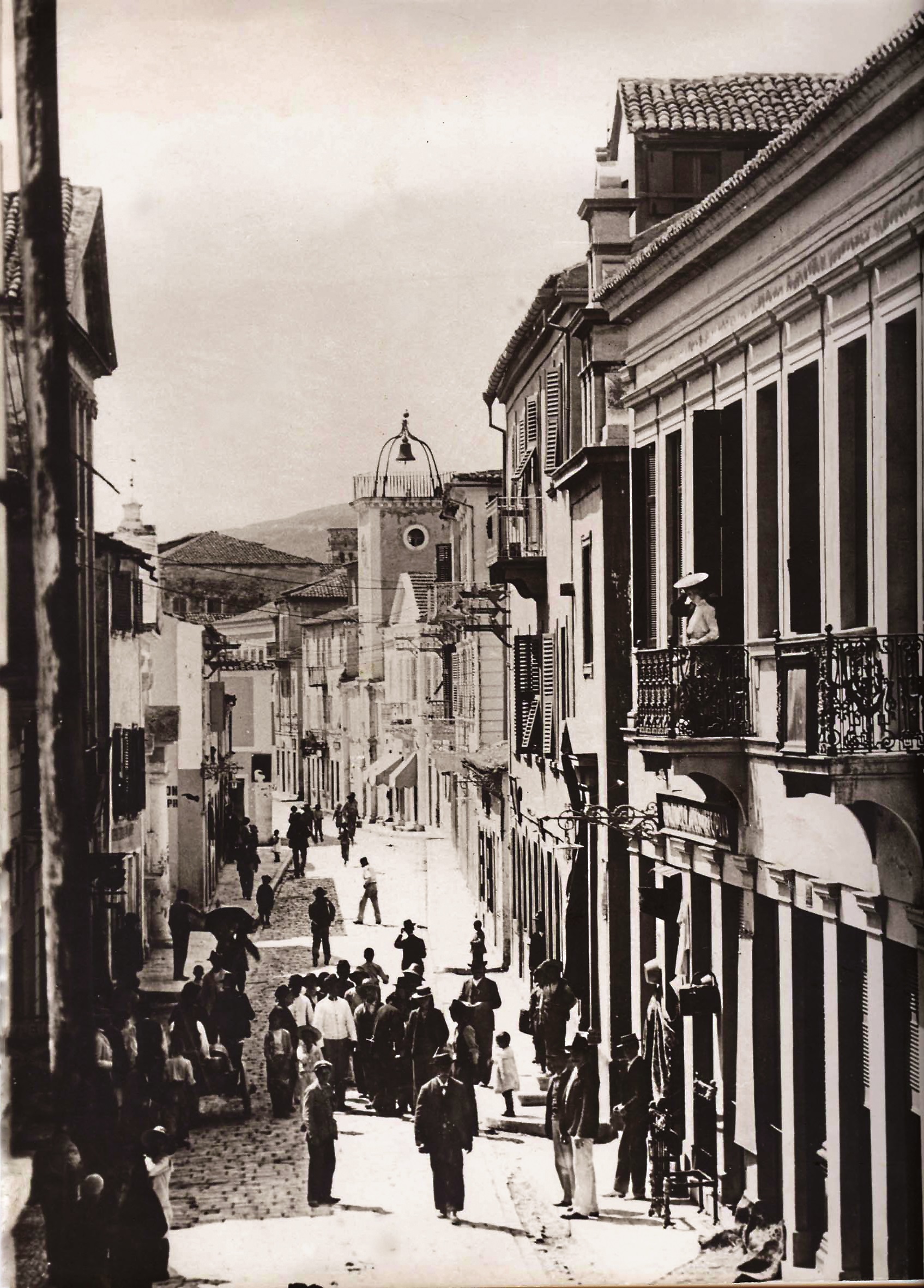
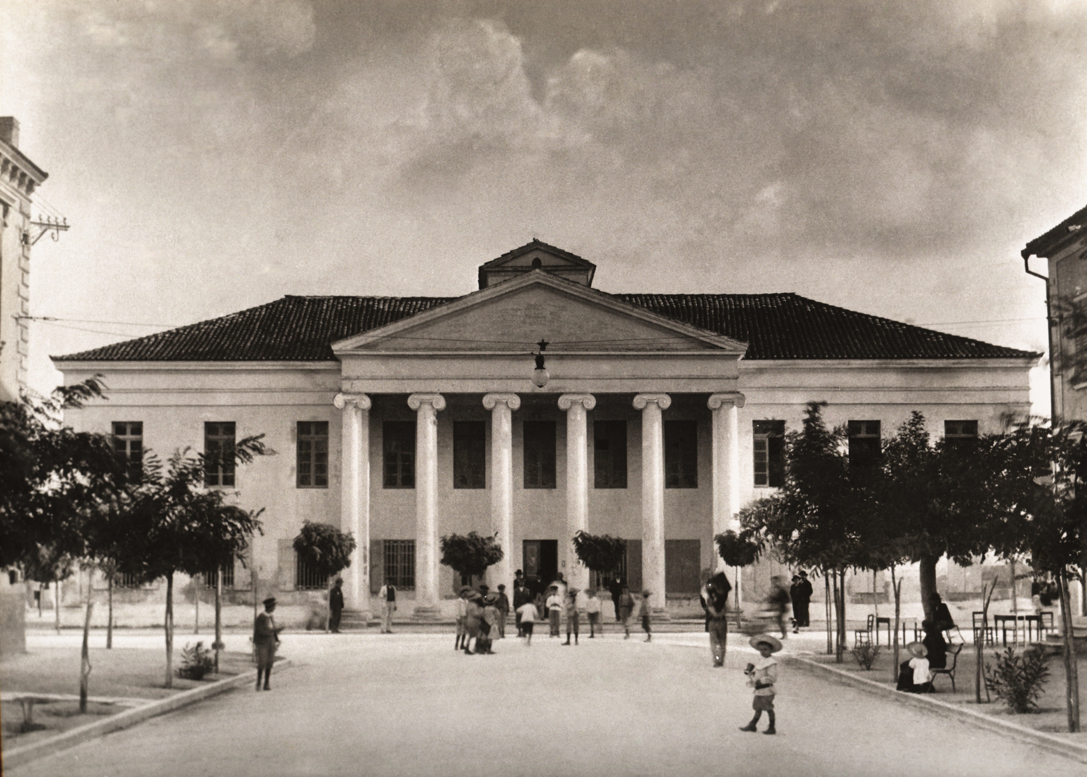
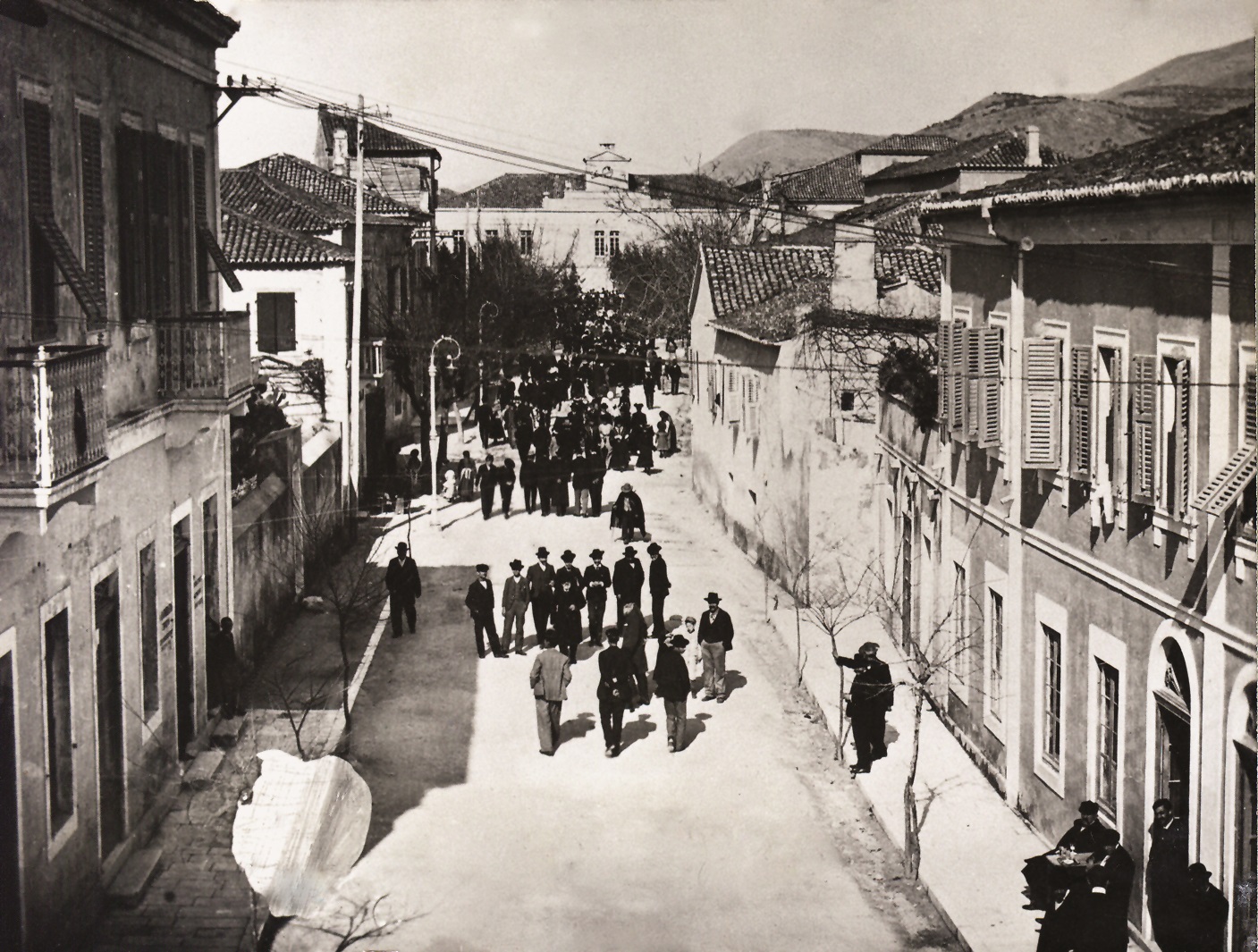
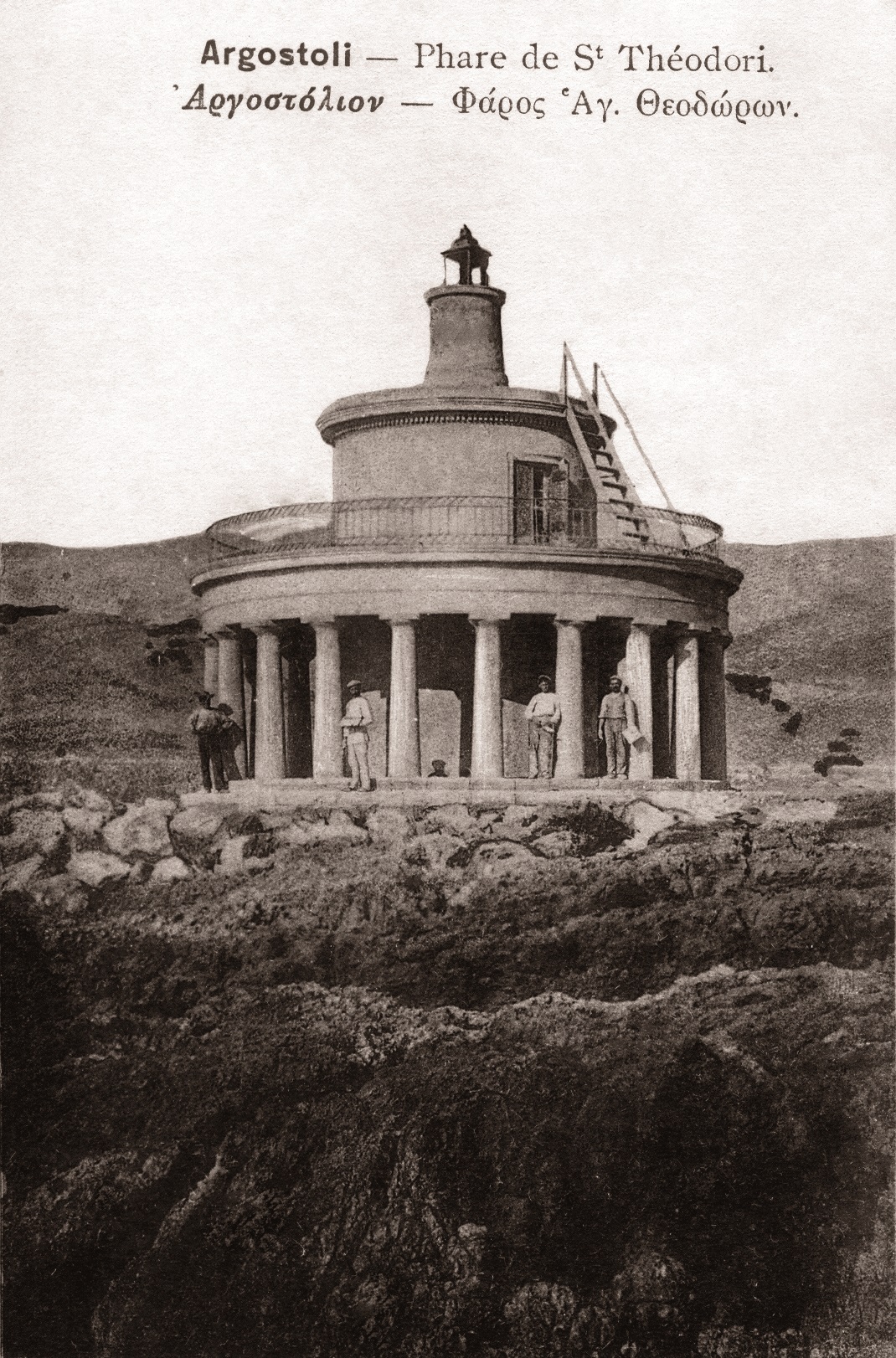
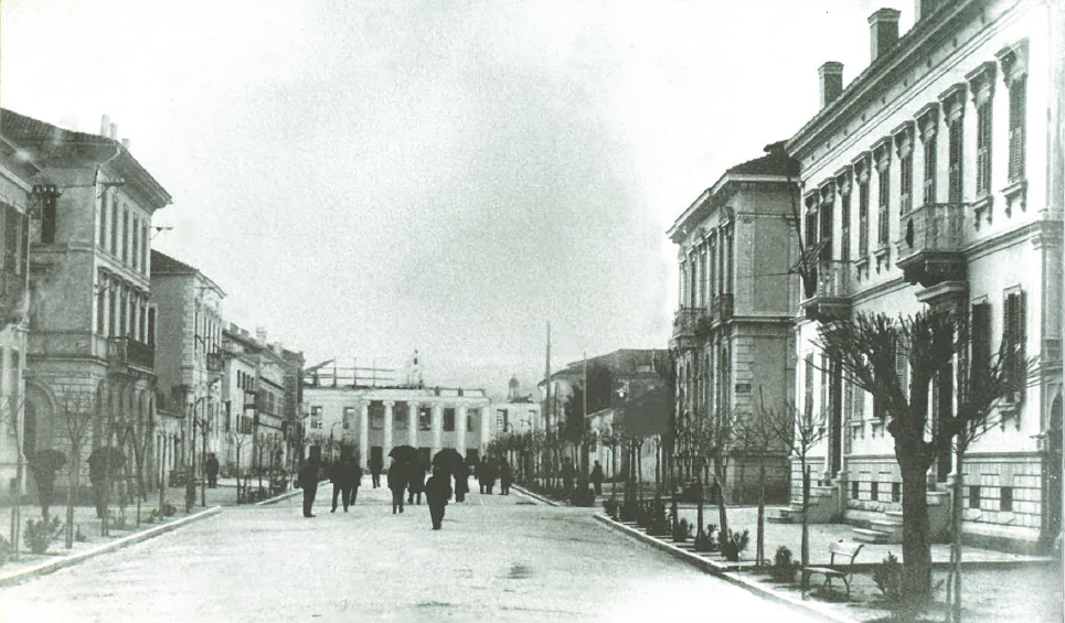
the stone paved (Lithostroto) street (Fig. 10) the waterfront (Fig. 11), the Court House (Fig. 12, 13), the Lighthouse of St Theodori (Fig. 14), etc.
The construction of usually one or two storey buildings of rectangle or Γ shape, followed hygienic rules and conditions that would assure the elegance of the exterior and would not affect the architectural aesthetics of the settlement under development.
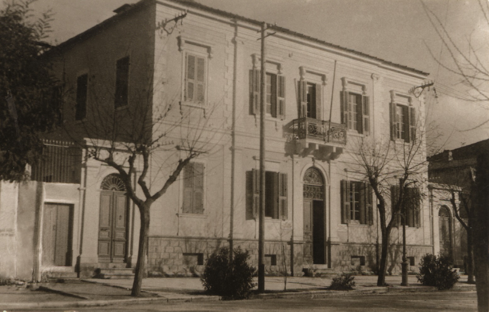
Some of these constructions were quite large and designated as urban mansions (e.g. the 22-room mansion of Kamilou-Vergoti (architect Anastasios Metaxas), the 33–room mansion of Gentilini-Kosmetatou, etc.) (Fig. 15, 16), casernes for the establishment of British soldiers, or public houses with similar structure to those found in Venice.
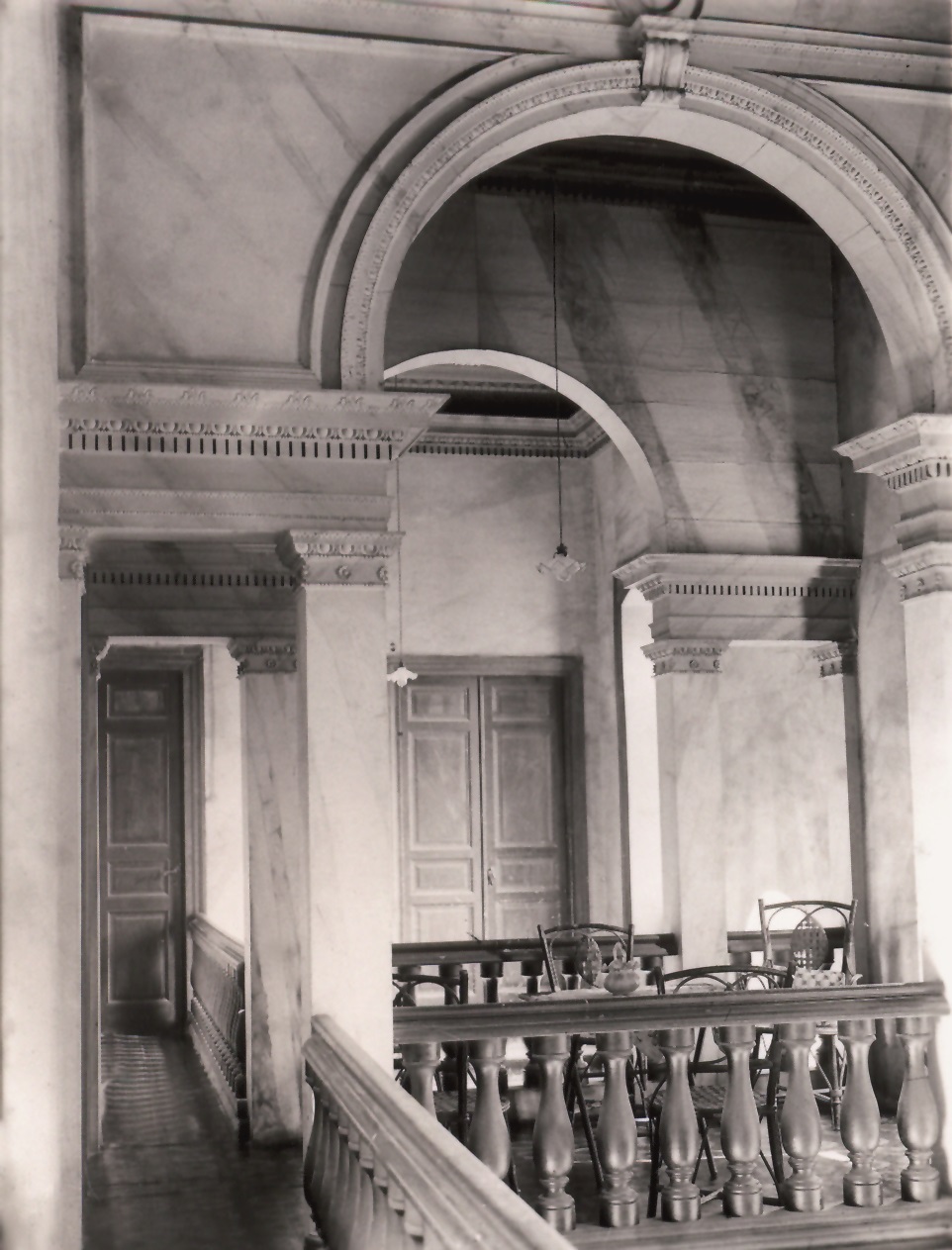
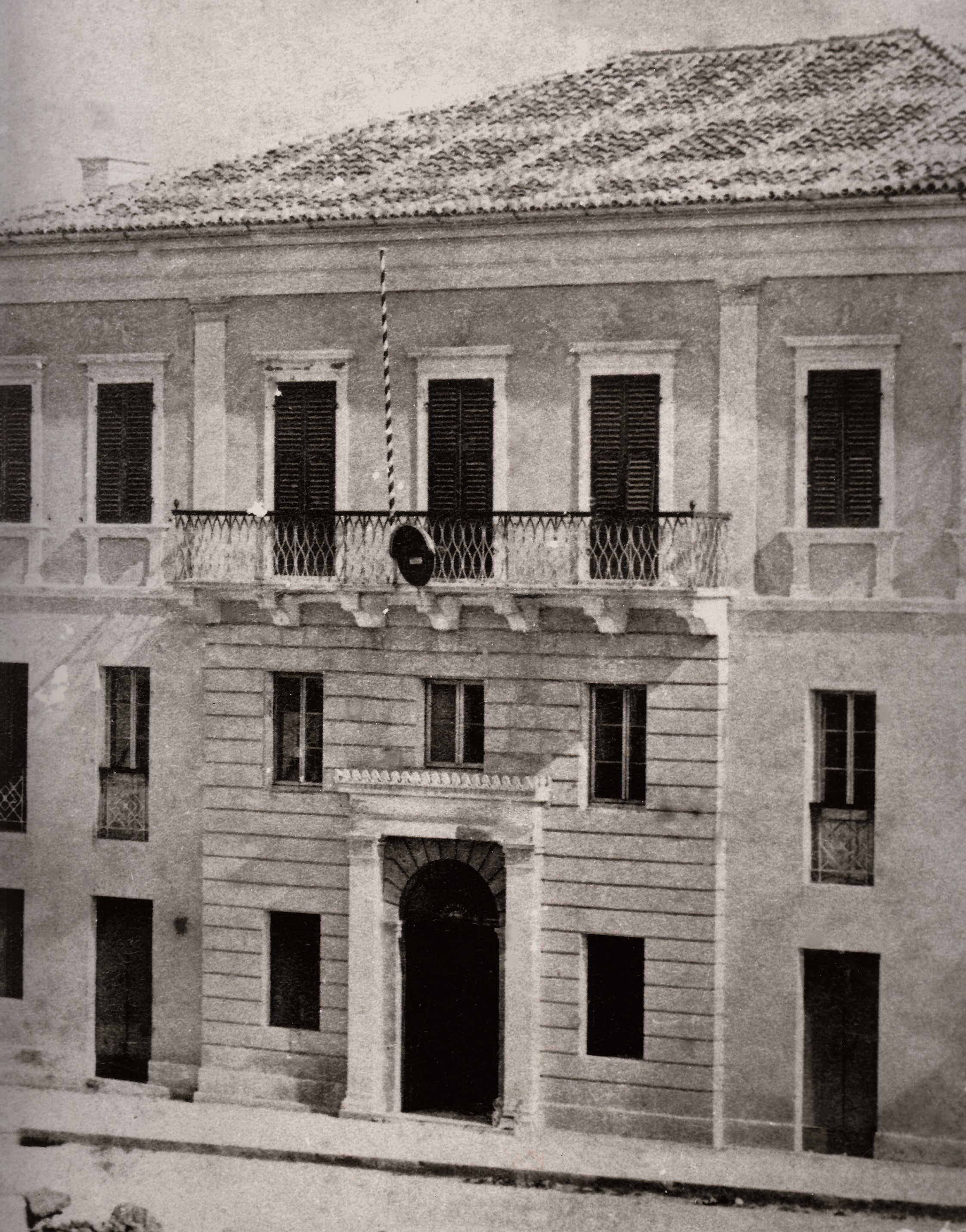
The buildings in general were designed in a quite simple style, based on the neoclassical architecture which was applied to Corfu mansions. In some of the buildings the portico (main door) was placed centrally under the balcony; it was larger than the other external doors and provided with an arched semicircular lintel of elaborate decoration (Fig. 17, 18). The outer corners of the mansions were covered by local stone such as flint extracted from Metaxata or limestone deriving from the hill of Falari. The fronts were lightly yellowish / gray, rosso antico, or "rosangelica" and the window coverings were green, brown or light gray. Arched front doors led to the courtyard or to side stairs, p.es. Germeni mansion which housed the Philarmonic School of Kefalonia (Fig. 19).
The layout of Lixouri square was also based on Kennedy's designs. Lixouri used to be the most important urban settlement on the island until the end of the 18th century. Around the square, the City Hall and the Court House were built, behind which it was found the Agora (market) with a fountain and the Holly Temple of Pantokrator.